
NYC Ferry is the city’s most underrated way to move, and most New Yorkers still haven’t figured that out.
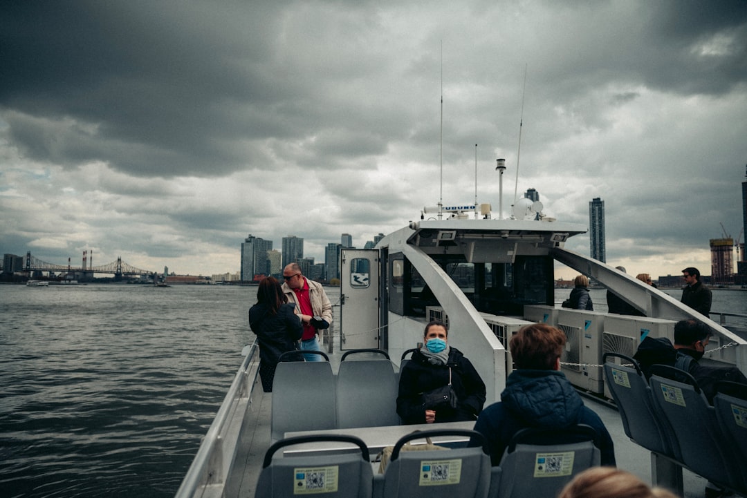
Most people grow up riding the subway and never look up. But when you step onto a ferry and watch the Manhattan skyline pull away from the dock, something shifts. The water is the oldest highway this city has, and NYC Ferry puts it back in your hands. This guide covers the routes, the stops, and the things worth seeing once you get off the boat.

Why NYC Ferry works for exploring the city
With 25 landings across 70 nautical route miles, NYC Ferry connects commuters and visitors to jobs, recreation, and each other across every borough. That is not just a statistic. It means you can board in Astoria, Queens, ride past the United Nations building, and step off at Pier 11 in lower Manhattan without touching a single subway car.
The system operates 38 vessels across 6 routes and 25 landings, making it the largest passenger-only ferry fleet in the United States. For visitors, that scale matters. You get real transit reach combined with open-air views that no underground train can offer.
Most routes run from approximately 5 AM to 10 PM, and the system operates daily, connecting all 5 boroughs. Tickets can be purchased through the NYC Ferry mobile app or at vending machines at each landing.

NYC Ferry routes and what each one covers
The East River route is the busiest and the most scenic. The East River route is always the most popular, and it regularly accounts for around 37 percent of total weekly ridership. It connects Long Island City in Queens to stops along the Manhattan waterfront, with access to neighborhoods like the Upper East Side, Midtown East, and the Financial District.
The Astoria route brings Queens riders through the Brooklyn Navy Yard and down to Pier 11. The South Brooklyn route covers Atlantic Avenue, Bay Ridge, and now extends to Staten Island. Linking Staten Island to Brooklyn and Pier 11 has unlocked new opportunities for commuters and supported the local economy on the North Shore. That connection is new and changes a lot for people who live on the island.
The first phase of the system launched in 2017 with service along the East River and to the Rockaways, Bay Ridge, and Astoria. A second phase launched to the Lower East Side and Soundview in 2018. The Soundview stop serves the Bronx, which completes the borough count. So yes, all 5 are covered.
The best stops to get off and explore
Pier 11 at Wall Street is the central hub. From there, you can walk to the Seaport District, Brooklyn Bridge, and Battery Park in minutes. It is also where you transfer between almost every route for free.
Astoria, Queens, is worth a full afternoon. The waterfront park there gives you an unobstructed view of the Hell Gate Bridge, and the surrounding streets are full of Greek tavernas, Brazilian spots, and one of the city’s best food scenes. In Brooklyn, the Atlantic Avenue stop puts you close to Brooklyn Heights Promenade, a walkway that gives you the best street-level view of lower Manhattan anywhere in the city.
For the Bronx, the Soundview stop sits near Clason Point Park. It is quiet, it is local, and it feels nothing like the tourist trail. That is the whole point of the ferry. NYC Ferry is not only a transit option for daily commutes but also a link between job centers, parks, and cultural destinations in all 5 boroughs.






Expert perspective on NYC Ferry’s growth
The ridership numbers tell a clear story: New Yorkers and visitors have embraced the ferry as a genuine transit option, not just a novelty. In 2025, the system crossed 1 million boardings in a single month for the first time. That milestone reflects years of investment in landings, vessels, and route design. What is especially significant is the spread of ridership across multiple boroughs, not just Manhattan. Waterfront communities that were historically underserved by the subway now have a direct, affordable link to job centers and cultural destinations. The Ferry Optimization Plan, the first comprehensive redesign since the system launched in 2017, responds directly to that demand. It shortens travel times, adds new landings, and improves frequency. The data shows that when you give people a good transit option, they use it.
Industry perspective, public transit and urban waterfront development professionals in New York City
Practical tips for riding the NYC Ferry schedule
Fares are affordable and consistent across the network. Seniors and people with disabilities can enroll in the NYC Ferry Discount Program to pay $1.45 per one-way ticket, and high-school students can also access discounts by applying at ferry.nyc. Standard fares are the same price regardless of distance, so a trip from Astoria to Bay Ridge costs the same as a 3-stop ride.
The redesign of the system will shorten travel times, provide more destinations, improve on-board capacity, and increase trip frequency. That means the schedule you ride today is already better than it was 2 years ago, and it is still improving. Check the app before you go, because some routes run less frequently on weekdays versus weekends.
NYC Ferry also operates free shuttle buses in the Rockaways to connect riders with ferry landings and nearby neighborhoods. If you plan to hit Rockaway Beach, use the shuttle. It saves you a long walk along a flat stretch of road in summer heat.
Conclusion: NYC Ferry belongs in every visitor’s plan
NYC Ferry is not a tourist gimmick. It is real transit with real reach, and it shows you this city from an angle that most people never see. NYC Ferry carried more than 7.4 million passengers in 2024, the highest yearly ridership in its history. New Yorkers voted with their feet. Now it is your turn. Ride NYC Ferry from one borough to another, get off somewhere you have never been, and walk until the neighborhood surprises you. That is how this city actually works.

Discover more about NYC Ferry
- NYC Ferry Routes and Schedules
- NYCEDC NYC Ferry Project Overview
- NYCEDC Announces NYC Ferry Route Changes, System Growth, and Future Vision